

Sydney Build is Australia’s largest construction and design show, held every year at the International Convention Centre at Darling Harbour in the heart of Sydney.
The event attracts 25,000-plus attendees and 550-plus speakers across 15 stages, as well as 600-plus exhibitors. There also are networking parties, a government hub and an architect’s hub.
Themes will include:
- AI and digital construction
- Sustainability
- Diversity, inclusion and reconciliation
- The future of housing
- Health and safety
- Architecture and design
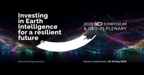
Registration is open for the 2026 GEO Symposium and GEO-21 Plenary, which will take place from 26 to 28 May 2026 in Geneva, Switzerland.
Held under the theme of ‘Investing in Earth Intelligence for a Resilient Future,’ the event will convene governments, space agencies, research organisations, private sector innovators, and development partners to explore how Earth intelligence (EI) can drive transformative, resilient solutions for people and the planet at a pivotal moment in the implementation of GEO’s Post-2025 Strategy.
The sessions will highlight user-driven solutions, open data and open knowledge practices, co-designed products and services, emerging partnerships, and investment opportunities that advance EI and GEO priorities.
The event will be livestreamed, for which registration is not required.

LOCATE is Australia and New Zealand’s flagship geospatial event, where the region’s smartest minds meet to explore the technologies, ideas and innovations shaping our world.
Each year, leaders from government, industry, research, and emerging sectors come together to uncover the latest breakthroughs and real-world applications transforming infrastructure, environment, agriculture, energy, mining, emergency response, and urban planning.
If you want to stay ahead of spatial trends, connect with decision-makers, and be part of the conversations driving smarter, data-led futures, this is the place to be.
LOCATE26 will be held at the Melbourne Convention and Exhibition Centre from 24 to 26 November.
Organisers expect at least 1,000 people to attend, making it a not-to-be-missed opportunity for speakers to share their news and views, and for companies and organisations to promote their products and solutions to a prime audience.
Co-located with LOCATE26 will be the 2026 Digital Earth Summit, a major annual global conference of the International Society for Digital Earth (ISDE).
The ISDE has brought together global experts for more than two decades, delivering world-leading summits and symposia across 15 countries. In 2026, the combination of the Summit and LOCATE26 will bring a unique international gathering of scientists, industry innovators, educators and government leaders to Australia.