

The INTERGEO EXPO and CONFERENCE brings together hundreds of exhibitors and thousands of delegates from around the world, to discuss with, learn from and network with others in the sectors of geodesy, geoinformation and land management.
The event presents an opportunity for vendors to showcase their innovative geodata-based solutions to an international audience over three days, addressing current challenges such as climate change, urbanisation and sustainable land use.
The 2024 event in Stuttgart attracted more than 550 exhibitors and more than 17,000 visitors.
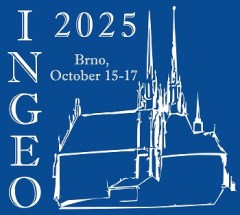
INGEO 2025, the 9th International Conference on Engineering Surveying, continues the series of meetings that began in 1998.
The aim of the conference is to bring together professionals in the field of engineering surveying and other related professions, such as civil engineering, mechanical engineering, geoinformatics, geotechnics and so on, to discuss new technologies and development.
The main topics of discussion will be:
- 3D modelling of buildings and engineering structures, BIM
- Smart cities, data collection, sensors, ISs and IOT applications
- Cultural heritage documentation, data collection, 3D modelling
- Indoor navigation (SLAM, RFID, TOF, etc.), low-cost systems and applications
- Deformation measurement, automated measuring systems
- Industry surveys, application of modern technology for power plants, nuclear facilities, etc.,
- Standards and quality assurance of engineering surveys

C.R. Kennedy and Leica Geosystems will showcase the Leica TS20 robotic total station at a series of launch events around Australia.
According to Leica Geosystems, the TS20 features upgraded hardware, software, and connectivity for a faster, quieter and more reliable experience in the field. From wireless communication and field and office software to theft deterrence and data sync, it’s fully connected and secured.

The Association for Geographic Information’s (AGI) Foresight Conference 2025 will be held in London on 13 November, at which will be launched the The Foresight Report 2030, the result of a 12-month project exploring the opportunities and challenges facing the geospatial sector over the next five years.
The conference agenda features an keynote presentation from Ed Parsons, Geospatial Technology Advisor and Google’s first ever Geospatial Technologist, who will be joined by representatives from Amentum, AtkinsRéalis, Idox Geospatial, 1Spatial and the North Sea Transition Authority.
The innovative geospatial sector program also features opportunities to explore the themes of the Report — the Data Imperative, the AI Integration Challenge, Infrastructure Evolution, the Collaboration Imperative, Earth Systems Revolution, Skills Revolution, and the Convergence Effect.
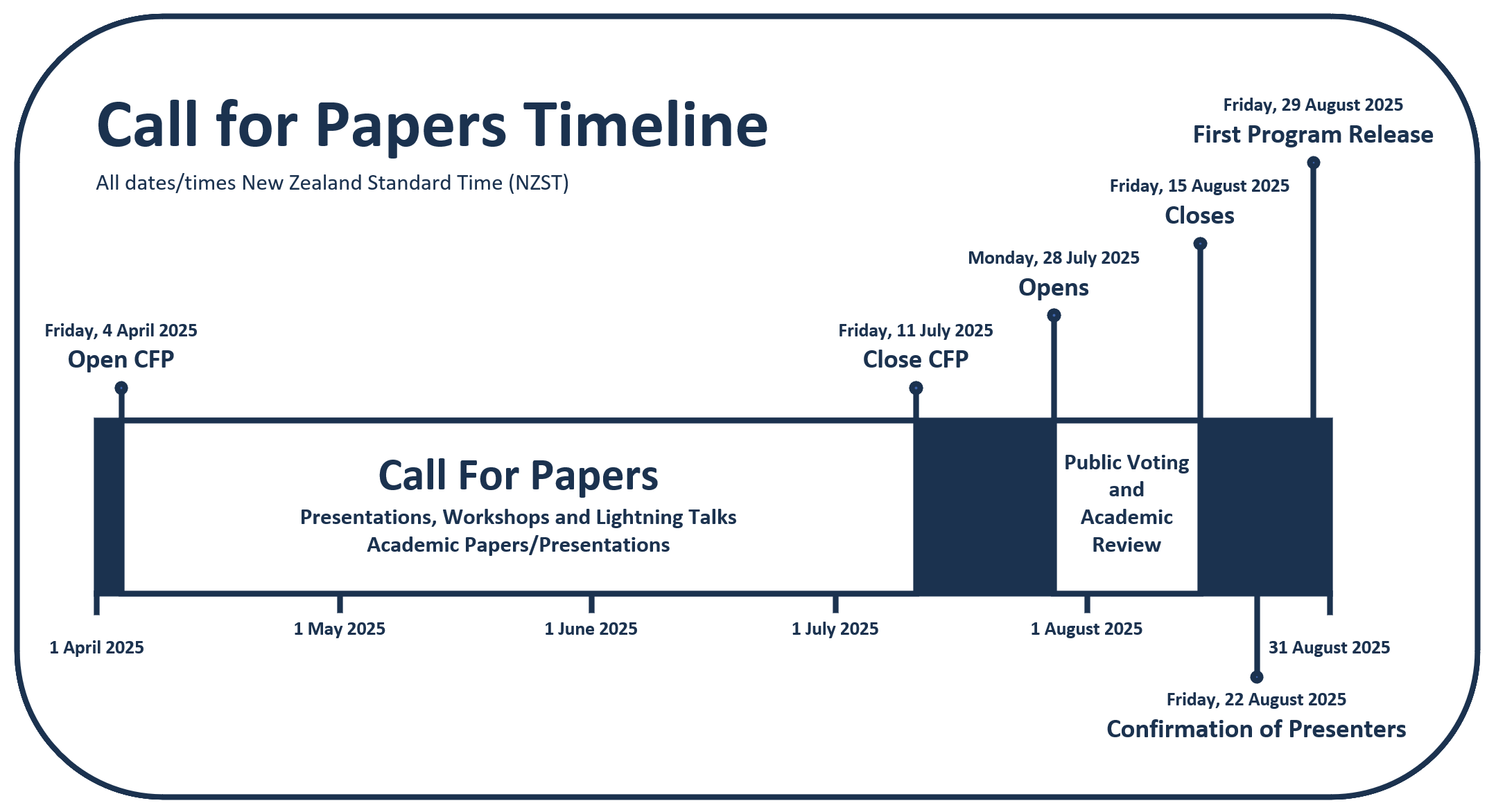
The Free and Open Source Software for Geospatial (FOSS4G) conference series, hosted in partnership with OSGeo, brings together open source geospatial users, software developers, decision makers and researchers from around the world.
The FOSS4G 2025 conference in Auckland, New Zealand, will be a vibrant gathering that fosters collaboration and celebrates innovation in the exciting world of free and open source software for geospatial.
The event will feature workshops, technical sessions, keynote addresses, ‘lightning talks,’ code sprints and community events, social events and a ‘women in geospatial’ breakfast.
It is expected that the full program will be made available in August 2025.
C.R. Kennedy and Leica Geosystems will showcase the Leica TS20 robotic total station at a series of launch events around Australia.
According to Leica Geosystems, the TS20 features upgraded hardware, software, and connectivity for a faster, quieter and more reliable experience in the field. From wireless communication and field and office software to theft deterrence and data sync, it’s fully connected and secured.