
FOSS4G Perth is a local, community-driven gathering of the Perth open geospatial community, focused on sharing news of developments in free and open-source software for geospatial applications.
The event will be an opportunity to share ideas about open-source tools, such as QGIS, PostGIS, OpenStreetMap, Sentinel-2 satellite imagery, Python-based Earth observation libraries and frameworks, GDAL, and many others.
This year’s event will be held in conjunction with the ISPRS Technical Commission IV Symposium.
The 2024 FOSS4G Perth organising committee comprises:
- Bryan Boruff – University of Western Australia
- Cholena Smart – Mammoth Geospatial
- Grant Boxer – Consultant Geologist
- Ivana Ivanova – Curtin University
- John Bryant (Chair) – Mammoth Geospatial
- John Duncan – University of Western Australia
- John Lang – Consultant
- Keith Moss – WA Government
- Michel Nzikou – DMN Solutions
- Nimalika Fernando
- Petra Helmholz – Curtin University
- Piers Higgs – Gaia Resources
- Renee Manser
- Stafford Smith
- Tracey Cousens – Mineral Resources Limited
- Vincent Dinh – GIS Pro

The complexities of understanding and forecasting evolutionary processes necessitate geographic modelling and simulation, which have emerged as potent tools for addressing critical issues such as climate change and sustainable resource use. But there is a pressing need for an open geographical modelling and simulation framework. Such a framework would serve as a catalyst, attracting more scholars and encouraging their collective efforts to address geographic challenges.
This workshop is designed to explore pertinent theories, approaches and potential applications, while fostering communication among experts from diverse domains. Its primary objectives include stimulating extensive discussions regarding the potential directions of the field and promoting further research, thus paving the way for a promising future in collaborative geographic modelling and simulation.
Organisers:
- School of Geography Science, Nanjing Normal University, China
- Key Laboratory of Virtual Geographic Environment (Ministry of Education of PRC), Nanjing Normal University, China
- International Geographical Union – Modeling Geographical Systems Commission
Co-organisers:
- International Environmental Modelling and Software Society
- The International Association of Chinese Professionals in Geographic Information Sciences
- Geographic Model and Geographic Information Analysis Commission, The Geographical Society of China
- Working Group on Education and Capability Building for Digital Earth, International Society for Digital Earth
- Jiangsu Center for Collaborative Innovation in Geographical Information Resource Development and Application, China
- National Earth System Science Data Center – Yangtze River Delta Subcenter
- School of Environment, Nanjing Normal University
Important dates:
- Abstracts due: 20 August 2024
- Early-bird registration ends: 31 August 2024
FOSS4G SotM Oceania will be a gathering enabling the open geospatial community to come together and ‘geek out’ over all things open geospatial.
FOSS4G events are part of a conference series run by the OSGeo community with the objective of fostering and promoting the adoption of open source geospatial technology.
SotM refers to the conference of the OpenStreetMap Foundation (OSMF), supporting the development of the OpenStreetMap project. FOSS4G SotM Oceania is part of the larger global community, and merges the two conferences into one exciting Oceania-centred event.


The 2024 Western Australian Geospatial Conference will be a dive deep into the latest technologies, trends, and best practices shaping the geospatial sector in Australia. The conference will give professionals ranging from GIS specialists to remote sensing experts the chance to gain valuable insights and forge new partnerships.
The event will conclude with the 2024 Western Australian Geospatial Excellence Awards ceremony, which will celebrate achievements and innovations by individuals and organisations within Western Australia’s geospatial sector.
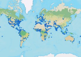
GIS Day is an international day dedicated to showing, teaching and inspiring others. Businesses and organisations are encouraged to host an event to spread enthusiasm and help people learn how to use GIS for themselves — in their work, in their schools or where they volunteer.
The event began in 1999, when Esri’s Jack Dangermond, Dr. Roger Tomlinson, and students celebrated the first GIS Day at Murch Elementary School in Washington, DC.
This year’s theme, ‘Mapping Minds, Shaping the World,’ highlights how GIS technology has changed the way we perceive, navigate and shape our world. It shows how combining human creativity with technology helps us discover hidden trends, support sustainable growth, and make smarter decisions using the power of location data.
At the time of writing (mid-October, 2024), around a dozen events were planned across Australia, New Zealand and the South Pacific. Organisers can register their events on the event website.

The 2024 ACT Geospatial Conference will be a dive deep into the latest technologies, trends, and best practices shaping the geospatial sector in Australia. The event will give professionals ranging from GIS specialists to remote sensing experts the chance to gain valuable insights and forge new partnerships.
The event will conclude with the 2024 ACT Geospatial Excellence Awards ceremony, which will celebrate achievements and innovations by individuals and organisations within ACT’s geospatial sector.
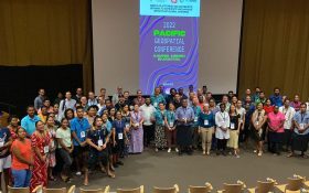
The 2024 Pacific Islands GIS & Remote Sensing Users Conference is reputably the largest GIS and remote sensing conference attended by Pacific Islanders, who leverage this annual opportunity to network and pursue partnerships with practitioners from around the globe.
The conference spotlights the latest innovative technologies, promotes knowledge and capacity development and sharing of best practices, and attracts a gathering of more than 300 attendees.
The theme for the 2024 event will be ‘Sustainable management of coastal areas through remote sensing and GIS.’

The 2024 Free and Open Source Software for Geospatial Conference (FOSS4G) will be held in Belém, Brazil, located in the heart of the Amazon.
FOSS4G, an annual event organised by the Open Source Geospatial Foundation (OSGeo) since 2006, is one of the largest global meetings on geospatial software of the year.
The local organising committee will be comprised of passionate Brazilians experienced in OSGeo technologies, along with the Geoinquietos Argentina team.
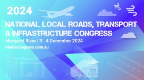
The Australian Local Government Association will host a national congress on roads and infrastructure from 3 to 4 December 2024, in Margaret River, Western Australia.
The congress is aimed at mayors, shire presidents, councillors, CEOs, general managers and local government engineers and works managers, and typically includes sessions on road funding, road safety and heavy vehicle access.
There is also usually a focus on community infrastructure, encompassing renewable energy deployment and integration, innovations in active transport, waste and recycling, affordable housing and resilient telecommunications.

In celebration of the International Day of Women and Girls in Science, Earth Observation Australia will conduct a special webinar that will shine a spotlight on the role women play in Earth observation (EO) science and technology.
This webinar will explore the journeys of women who have overcome challenges to lead ground-breaking work in EO science. The session will highlight their achievements, the barriers they’ve faced, and the importance of mentorship and collaboration in empowering the next generation of women scientists. Attendees will gain insights into fostering inclusive networks and strategies to support women in leadership roles within this critical field.


