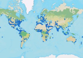
GIS Day is an international day dedicated to showing, teaching and inspiring others. Businesses and organisations are encouraged to host an event to spread enthusiasm and help people learn how to use GIS for themselves — in their work, in their schools or where they volunteer.
The event began in 1999, when Esri’s Jack Dangermond, Dr. Roger Tomlinson, and students celebrated the first GIS Day at Murch Elementary School in Washington, DC.
This year’s theme, ‘Mapping Minds, Shaping the World,’ highlights how GIS technology has changed the way we perceive, navigate and shape our world. It shows how combining human creativity with technology helps us discover hidden trends, support sustainable growth, and make smarter decisions using the power of location data.
At the time of writing (mid-October, 2024), around a dozen events were planned across Australia, New Zealand and the South Pacific. Organisers can register their events on the event website.

The 2024 ACT Geospatial Conference will be a dive deep into the latest technologies, trends, and best practices shaping the geospatial sector in Australia. The event will give professionals ranging from GIS specialists to remote sensing experts the chance to gain valuable insights and forge new partnerships.
The event will conclude with the 2024 ACT Geospatial Excellence Awards ceremony, which will celebrate achievements and innovations by individuals and organisations within ACT’s geospatial sector.
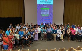
The 2024 Pacific Islands GIS & Remote Sensing Users Conference is reputably the largest GIS and remote sensing conference attended by Pacific Islanders, who leverage this annual opportunity to network and pursue partnerships with practitioners from around the globe.
The conference spotlights the latest innovative technologies, promotes knowledge and capacity development and sharing of best practices, and attracts a gathering of more than 300 attendees.
The theme for the 2024 event will be ‘Sustainable management of coastal areas through remote sensing and GIS.’

The 2024 Free and Open Source Software for Geospatial Conference (FOSS4G) will be held in Belém, Brazil, located in the heart of the Amazon.
FOSS4G, an annual event organised by the Open Source Geospatial Foundation (OSGeo) since 2006, is one of the largest global meetings on geospatial software of the year.
The local organising committee will be comprised of passionate Brazilians experienced in OSGeo technologies, along with the Geoinquietos Argentina team.

The Australian Local Government Association will host a national congress on roads and infrastructure from 3 to 4 December 2024, in Margaret River, Western Australia.
The congress is aimed at mayors, shire presidents, councillors, CEOs, general managers and local government engineers and works managers, and typically includes sessions on road funding, road safety and heavy vehicle access.
There is also usually a focus on community infrastructure, encompassing renewable energy deployment and integration, innovations in active transport, waste and recycling, affordable housing and resilient telecommunications.

In celebration of the International Day of Women and Girls in Science, Earth Observation Australia will conduct a special webinar that will shine a spotlight on the role women play in Earth observation (EO) science and technology.
This webinar will explore the journeys of women who have overcome challenges to lead ground-breaking work in EO science. The session will highlight their achievements, the barriers they’ve faced, and the importance of mentorship and collaboration in empowering the next generation of women scientists. Attendees will gain insights into fostering inclusive networks and strategies to support women in leadership roles within this critical field.

The Geo Week exhibition and conference is described by its organisers as being “the learning and networking nexus of the geospatial and built worlds,” attracting professionals from a wide variety of industries and disciplines.
The 2024 event had 3,400-plus registrants and hosted a record 2,976 delegates onsite from more than 45 nations.
Geo Week 2025 will convene 3,000-plus attendees from six continents, and will include collocated user meetings (ASPRS, MAPPS, USIDB and more to be announced).
Use the code SAVE100 when registering for a US$100 discount and/or FREE expo admission with lots of valuable benefits included.
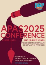
The Association of Public Authority Surveyors (APAS) 2025 Conference will be held at the Rydges Resort Hunter Valley, Lovedale, NSW, in March 2025. The theme of the event will be ‘Plumb lines and mulled wines’.
The current program (continually updated) can be found here, and includes a gala dinner.
APAS is a non-profit organisation that brings together surveyors and closely allied spatial information professionals employed by public authorities in NSW and the Australian Capital Territory.

Now in its second decade, the Aus Gov Data Summit is dedicated to advancing the government’s agenda of leveraging data as a national strategic asset. This premier event aims to empower Australian public service data leaders to elevate their missions, increase efficiency, and deliver exceptional public services.
With more than 500 leaders from federal state, and local governments expected to attend, the summit will feature an expanded program with four dedicated streams: C-suite, data and analytics, ICT leadership and innovation, and cybersecurity. Each stream is specifically tailored to address the critical challenges and opportunities within the Australian public service data ecosystem.
Image credit: ©stock.adobe.com/au/r-o-x-o-r


