
The 4th International Symposium on Applied Geoinformatics (ISAG2024), which will take place at the Wroclaw University of Science and Technology, Wroclaw, Poland, on 9 and 10 May 2024. ISAG2024 is jointly organised by the Department of Geomatics Engineering, Yildiz Technical University, Istanbul, Türkiye, Wroclaw University of Science and Technology, Wroclaw, Poland and Technical University of Crete, Chania, Crete, Greece.
The aim of the 4th ISAG is to bring scientists, engineers and industry researchers together to exchange and share their experiences and research results and discuss the practical challenges encountered and the solutions adopted in geoinformatics.
Topics to be covered include recent advances in AI, satellite imagery, advanced remote sensing, photogrammetry, image processing, global navigation satellite systems, height systems, terrestrial laser scanning, GIS, smart cities and land management.

The 9th International Conference on Cartography and GIS will take place in Nessebar, Bulgaria from 16 to 21 June 2024. The ICCGIS is a biannual conference that began in 2006 and has been held every two years since (except for 2020). In total, the Conference has attracted attendees from more than 60 countries and has published more than 700 scientific papers in its proceedings.
The aim of the conference is to collect knowledge and share experiences about the latest achievements in the field of cartography and GIS. Multiple parallel events will take place during the conference, including annual meetings of ICA commissions and a special ISDE plenary session. There will also be a Seminar on Disaster Risk Reduction – Solutions and Innovations.

For professionals ranging from GIS specialists to remote sensing experts, the 2024 North Queensland Geospatial Conference conference will be an opportunity to gain invaluable insights, forge strategic partnerships, and unlock new avenues for growth and innovation.
For those seeking to expand their skill set, explore new technologies or simply connect with like-minded professionals, the conference will be a gateway to success in the ever-evolving world of geospatial technology.

FOSS4G Perth is a local, community-driven gathering of the Perth open geospatial community, focused on sharing news of developments in free and open-source software for geospatial applications.
The event will be an opportunity to share ideas about open-source tools, such as QGIS, PostGIS, OpenStreetMap, Sentinel-2 satellite imagery, Python-based Earth observation libraries and frameworks, GDAL, and many others.
This year’s event will be held in conjunction with the ISPRS Technical Commission IV Symposium.
The 2024 FOSS4G Perth organising committee comprises:
- Bryan Boruff – University of Western Australia
- Cholena Smart – Mammoth Geospatial
- Grant Boxer – Consultant Geologist
- Ivana Ivanova – Curtin University
- John Bryant (Chair) – Mammoth Geospatial
- John Duncan – University of Western Australia
- John Lang – Consultant
- Keith Moss – WA Government
- Michel Nzikou – DMN Solutions
- Nimalika Fernando
- Petra Helmholz – Curtin University
- Piers Higgs – Gaia Resources
- Renee Manser
- Stafford Smith
- Tracey Cousens – Mineral Resources Limited
- Vincent Dinh – GIS Pro
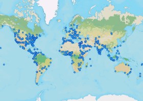
GIS Day is an international day dedicated to showing, teaching and inspiring others. Businesses and organisations are encouraged to host an event to spread enthusiasm and help people learn how to use GIS for themselves — in their work, in their schools or where they volunteer.
The event began in 1999, when Esri’s Jack Dangermond, Dr. Roger Tomlinson, and students celebrated the first GIS Day at Murch Elementary School in Washington, DC.
This year’s theme, ‘Mapping Minds, Shaping the World,’ highlights how GIS technology has changed the way we perceive, navigate and shape our world. It shows how combining human creativity with technology helps us discover hidden trends, support sustainable growth, and make smarter decisions using the power of location data.
At the time of writing (mid-October, 2024), around a dozen events were planned across Australia, New Zealand and the South Pacific. Organisers can register their events on the event website.
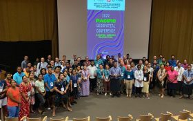
The 2024 Pacific Islands GIS & Remote Sensing Users Conference is reputably the largest GIS and remote sensing conference attended by Pacific Islanders, who leverage this annual opportunity to network and pursue partnerships with practitioners from around the globe.
The conference spotlights the latest innovative technologies, promotes knowledge and capacity development and sharing of best practices, and attracts a gathering of more than 300 attendees.
The theme for the 2024 event will be ‘Sustainable management of coastal areas through remote sensing and GIS.’
GISTAM 2025, the 11th International Conference on Geographical Information Systems Theory, Applications and Management will be a meeting point of researchers and practitioners that address new challenges in geospatial data sensing, observation, representation, processing, visualisation, sharing and management.
This includes all aspects of information communication and technologies as well as management information systems and knowledge-based systems.
The conference will present original contributions of either practical or theoretical nature, including research and applications of specialised or interdisciplinary natures, addressing different aspects of geographic information systems and technologies.
Topics to be covered include:
- Data acquisition and processing
- Remote sensing
- Interaction with spatial-temporal information
- Spatial data mining
- Managing spatial data
- Modelling, representation and visualisation
- GIS and climate change
- Domain applications
Deadlines:
- Regular Paper Submission: 13 December 2024
- Abstracts Track Submission: 30 January 2025

GIScience 2025, the 13th International Conference on Geographic Information Science, will be hosted by the University of Canterbury in collaboration with the GIScience academic research community across New Zealand.
The GIScience conference regularly attracts more than 250 international participants from academia, industry and government to discuss and advance the state-of-the-art in geographic information science.
The first day of the 2025 conference will be dedicated to workshops and tutorials, while the main conference program will run on the second and third days; it will include a single refereed paper track and an abstract track for posters and demo submissions.
GIScience 2025 welcomes papers, posters and demos covering emerging topics and fundamental research findings across all sectors of geographic information science, including (but not limited to) the role of geographic information in geography, computer science, engineering, information science, linguistics, mathematics, cognitive science, philosophy, psychology, social science and geostatistics.
Deadlines:
- Proceedings papers: 31 January 2025
- Workshop proposals: 14 February 2025
- Abstracts: 4 April 2025
- Demos: 4 April 2025
Image credit: ©stock.adobe.com/au/StudioProX

The INTERGEO EXPO and CONFERENCE brings together hundreds of exhibitors and thousands of delegates from around the world, to discuss with, learn from and network with others in the sectors of geodesy, geoinformation and land management.
The event presents an opportunity for vendors to showcase their innovative geodata-based solutions to an international audience over three days, addressing current challenges such as climate change, urbanisation and sustainable land use.
The 2024 event in Stuttgart attracted more than 550 exhibitors and more than 17,000 visitors.
The 2025 Pacific GIS & Remote Sensing User Conference will be held in Suva, Fiji, from 24 to 29 November.
This is the largest annual GIS and remote sensing event held within the Pacific Island community, regularly bringing together more than 300 experts from government, academia and industry for five days of presentations and workshops.
The event will also include nightly social functions that will enable participants to relax and network in informal settings.
The conference is organised by the Pacific GIS and Remote Sensing Council.


