The 2024 ACT Geospatial Conference will be a dive deep into the latest technologies, trends, and best practices shaping the geospatial sector in Australia. The event will give professionals ranging from GIS specialists to remote sensing experts the chance to gain valuable insights and forge new partnerships.
The event will conclude with the 2024 ACT Geospatial Excellence Awards ceremony, which will celebrate achievements and innovations by individuals and organisations within ACT’s geospatial sector.

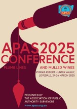
The Association of Public Authority Surveyors (APAS) 2025 Conference will be held at the Rydges Resort Hunter Valley, Lovedale, NSW, in March 2025. The theme of the event will be ‘Plumb lines and mulled wines’.
The current program (continually updated) can be found here, and includes a gala dinner.
APAS is a non-profit organisation that brings together surveyors and closely allied spatial information professionals employed by public authorities in NSW and the Australian Capital Territory.

Now in its second decade, the Aus Gov Data Summit is dedicated to advancing the government’s agenda of leveraging data as a national strategic asset. This premier event aims to empower Australian public service data leaders to elevate their missions, increase efficiency, and deliver exceptional public services.
With more than 500 leaders from federal state, and local governments expected to attend, the summit will feature an expanded program with four dedicated streams: C-suite, data and analytics, ICT leadership and innovation, and cybersecurity. Each stream is specifically tailored to address the critical challenges and opportunities within the Australian public service data ecosystem.
Image credit: ©stock.adobe.com/au/r-o-x-o-r

GISTAM 2025, the 11th International Conference on Geographical Information Systems Theory, Applications and Management will be a meeting point of researchers and practitioners that address new challenges in geospatial data sensing, observation, representation, processing, visualisation, sharing and management.
This includes all aspects of information communication and technologies as well as management information systems and knowledge-based systems.
The conference will present original contributions of either practical or theoretical nature, including research and applications of specialised or interdisciplinary natures, addressing different aspects of geographic information systems and technologies.
Topics to be covered include:
- Data acquisition and processing
- Remote sensing
- Interaction with spatial-temporal information
- Spatial data mining
- Managing spatial data
- Modelling, representation and visualisation
- GIS and climate change
- Domain applications
Deadlines:
- Regular Paper Submission: 13 December 2024
- Abstracts Track Submission: 30 January 2025

The third International Association of Geodesy (IAG) Commission 4 Symposium will bring together scientists, researchers and professionals working in the broad field of positioning and its applications.
The symposium will serve as a platform for discussing research that leverages current and emerging positioning techniques and technologies. It aims to provide both practical and theoretical solutions across a wide range of topics.
Discussions will address both technical and institutional aspects of developing GNSS backup systems, integrated positioning solutions, resilient PNT systems, and emerging LEO-based PNT techniques. The symposium will also explore space weather monitoring and forecasting through both ground-based and space-based geodetic observations. Additionally, the application of machine learning and artificial intelligence in geodesy will be examined.
The main topics to be covered include:
- Multi-frequency and multi-constellation GNSS technique
- Terrestrial and satellite-based positioning system development
- Multi-sensor fusion navigation and integrity monitoring
- Emerging positioning technologies, e.g., resilient PNT and LEO-based PNT
- Atmospheric space weather monitoring using geodetic observation techniques
- Applications of geodesy to engineering
- Artificial Intelligence technique for geodesy research


