

CSIRO geophysicists have used aeromagnetic data from 1999 to examine a below-ground region of the Northern Territory informally known as the Australia Magnetic Anomaly.
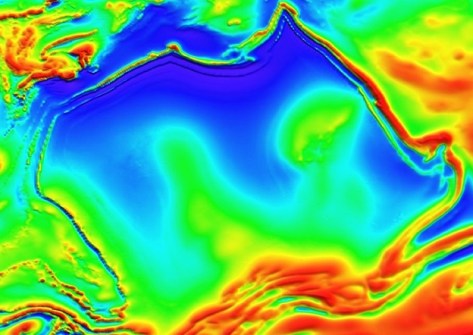
The region gets its name because its shape resembles that of the Australian continent.
The scientists, led by Dr Clive Foss, used the 27-year-old data and modern analysis techniques to peer beneath the surface of the NT desert to reveal what lies below … which cannot be done using surface mapping methods.
The Northern Territory’s often featureless landscape can make it very hard to determine what lies underneath the surface. This is where aeromagnetic data can help.
Revealing the hidden
The data used in the study (catalogue number P1008) were taken from just one of the many datasets dating back decades that are curated by Geoscience Australia.
It came from the 1999 Bonney Well Survey, which was flown for the Northern Territory Geological Survey on north-south flightlines with a spacing of 400 metres, nominal terrain clearance of 60 metres and with east-west tie lines spaced at 4 kilometres.
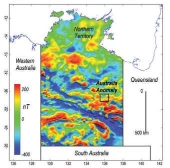
According to Dr Foss, earlier magnetic maps of the area were hampered by artefacts, especially where flightlines and magnetic structures closely lined up.
“My colleague, Dr Aaron Davis, created an innovative gridding algorithm which refined the dataset and produced cleaner, more consistent images,” said Dr Foss.
This meant the team was able to spot long-hidden features: geological boundaries, and subtle magnetic layers and signatures that revealed the shapes and orientations of below-ground structures.
“By improving how we process and model these datasets, we can extract more geological information than ever before,” Dr Foss said.
Old data is new again
The paper, Geomagnetophilia #5: The Australia magnetic anomaly, Northern Territory, was authored by Clive Foss, Aaron Davis and Sarath Patabendigedara, all from CSIRO Mineral Resources, and published in the February 2026 edition of the Australian Society of Exploration Geophysicists’ journal, Preview.
“Many regional aeromagnetic surveys across Australia were flown primarily to generate map images to assist geological mapping, but those datasets contain considerable quantitative information about subsurface magnetisations — much of which is yet to be recovered,” the authors write.
“The methods we present in this study are just some of those that can be applied to highly variable datasets across the country.”


