

SouthPAN’s L1 SBAS service has been put to the test on New Zealand’s South Island using a common lower-cost GNSS receiver, achieving impressive results in the process.
The aim of the test, undertaken by the Central Otago District Council (CODC), was to see if the L1 SBAS service, when combined with an affordable compatible receiver, could be used to substitute for, or supplement, traditional positioning technologies for day-to-day field operations.
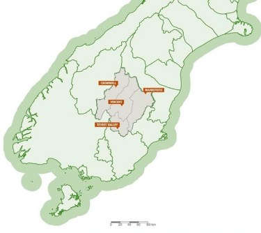
CODC is responsible for a very large region in the middle of the nation’s South Island, and has an ongoing need to map roads, parks, waterways and above- and below-ground built infrastructure.
Its extant GNSS-based positioning technologies work well but come with some limitations:
- Traditional equipment is expensive to own and needs skilled operators;
- Cost of ownership is high, and not only for the initial hardware — ongoing costs also include subscriptions, mobile data and upgrades;
- The use of traditional equipment needs extensive training;
- Standalone GPS accuracy is not sufficient; and
- Connectivity can be difficult in rural and remote areas.
The test involved the use of an Arrow 100 receiver, which can connect to any Android or iOS device and supports all GNSS constellations. It’s also vendor agnostic.
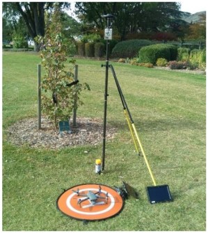
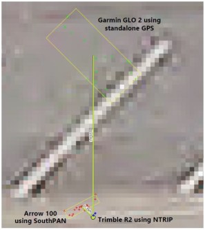
CODC settled on an order 5 survey mark in the town of Ranfurly as the reference point, and then captured a series of points using three different systems:
- A Garmin GLO 2 using standalone GPS;
- The Arrow 100 using SouthPAN L1 SBAS; and
- A Trimble R2 using NTRIP.
The Garmin achieved an average accuracy of 3.70 m, the Arrow scored an average of 0.35 m and the Trimble reached an average of 0.13 m.
Using the SouthPAN L1 SBAS service and the Arrow, CODC was able to achieve an accuracy that was much better than expected (usually 30 to 50 cm) and suitable for at least 75% of the Council’s mapping needs.
“It gives us reliable precision for most of our day-to-day work, without needing specialist equipment or training,” said Tony Hollows, GIS Lead at CODC.
CODC says that incorporating SouthPAN into its geospatial and asset management workflows brings improved efficiency and productivity, cost savings, and the flexibility of not being locked into a single-vendor ecosystem.
“SouthPAN can support councils to plan and respond more quickly,” said Michael Appleyard, SouthPAN program director at Toitū Te Whenua Land Information New Zealand (LINZ).
“Whether it’s maintaining underground utilities, mapping parks and roads, or supporting an emergency response, SouthPAN enables quicker, more precise work that saves both time and ratepayer money.”
“The results highlight how SouthPAN gives councils a way to improve asset management without increasing their technology budgets,” added Appleyard.
“It supports better data-driven decisions and makes accurate mapping accessible to everyone.”
The SouthPAN SBAS (satellite-based augmentation system) is a joint project of the Australian and New Zealand governments, being implemented by LINZ and Geoscience Australia.


