


A multi-year surveying project has propelled the Republic of Kiribati toward improved safety of navigation, resilience and economic growth.
By David Crossman
The Republic of Kiribati is one of the most remote nations in the world, comprising of 33 atolls and coral islands spread over 3,441,810 square kilometres of ocean, including all four quadrants of the Earth. Kiribati has approximately 132,000 citizens, who inhabit only 12 of the islands, with over half of the population on the main island of Tarawa.
However, Kiribati’s total land area is only 811 square kilometres, meaning that for the Republic and its people, not only is space extremely limited for living and for commerce, but the country is highly susceptible to the impacts of climate change.
Sea-level rise, climate change, heightened weather and storm surge all have a significant impact on everyday life in Kiribati. As most of the islands have a maximum elevation of only around two metres above sea level, rising sea levels and heightened weather events have caused increased coastal erosion and saltwater intrusion into the freshwater lens, while the impacts of La Niña mean less rain and therefore prolonged periods of drought.
In addition, I-Kiribati (the Kiribati people) face many other challenges, specifically resulting from a growing population, limited land and the geographic separation of its islands.
This includes limited land for agricultural and economic activity, and difficulties in the provision of critical infrastructure such as health care, power, potable water, education and so on, to the numerous isolated islands and populations.
The remoteness of Kiribati means that many of the uninhabited Outer Islands are virtually untouched by human intervention, boasting pristine reefs, oceans and marine ecosystems. However, the downside of this isolation is that opportunities for trade, economic growth, planning and infrastructure development are difficult. This is why the Kiribati Outer Islands Transport Infrastructure Investment Project (KOITIIP) is so important.
The aim of the program
KOITIIP is a large, multiphase development program led by the Government of Kiribati (GoK) and jointly funded by the World Bank and the Asian Development Bank. The development objective is to improve the connectivity, safety and climate resilience of transport infrastructure on selected Outer Islands and provide an immediate response in the event of a crisis.
The KOITIIP project has four components. The first, Safe Inter-Island Navigation, aims to carry out activities to improve the safety of inter-island navigation. The second component, Resilient Outer Island Access Infrastructure, has the following subcomponents:
- Improvement of ship safety navigation;
- Rehabilitation of island access infrastructure; and
- Rehabilitation of lagoon crossings.
The third component, Strengthening the Enabling Environment, has the following subcomponents:
- Institutional strengthening;
- Operational support for the Outer Islands Implementation Unit (OIIU); and
- Operational support for the Kiribati Fiduciary Services Unit (KFSU).
The fourth component, Contingent Emergency Response, would draw from the uncommitted resources under the project and from other project components to cover emergency response.

To achieve the KOITIIP outcomes, high-quality, high-resolution and accurate terrestrial and bathymetric information was required over the four selected Outer Islands of Tabiteuea, Nonouti, Abaiang and Beru.
This data was obtained by IIC Technologies Ltd (IIC) through the conduct of bathymetric data gathering using boat-based multibeam echosounders (MBES), and airborne bathymetric LiDAR, terrestrial LiDAR and high-resolution imagery.
In addition to the KOITIIP data-gathering effort, two additional follow-on contracts were undertaken in Kiribati by IIC. The first was a bathymetric survey of Betio Wharf and its approaches on the main island of Tarawa, commissioned by the United Kingdom Hydrographic Office (UKHO).
The second was an aerial campaign over Tarawa comprising bathymetric LiDAR, terrestrial LiDAR and high-resolution imagery. Both additional surveys were undertaken to the same specifications as the KOITIIP program to ensure consistency and continuity between the resulting data for the five islands.
The data-gathering campaign
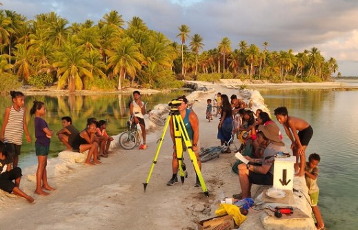
Data gathering in Kiribati commenced in March 2023 with the establishment of both geodetic and tidal control on the four outer islands and Tarawa. This was a crucial aspect of the survey given the lack of infrastructure and historical data in the region.
The geodetic observations assisted in the strengthening of the geodesy for each island and allowed for the provision of ground control for the subsequent aerial campaign.
The creation of high-accuracy tidal models was not only important to supporting the data gathering effort being undertaken for KOITIIP but will aid in the monitoring of sea-level rise and its potential impact for Kiribati into the future.
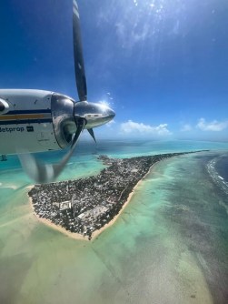
While the control surveys were being undertaken, the aerial team mobilised in New Zealand prior to travelling to Kiribati to commence data gathering. The aerial data-gathering campaign was undertaken using a CZMIL Supernova system.
Flying was prioritised based on weather, but also to minimise transit times and to work around the sometimes-limited availability of fuel. Aerial data gathering was undertaken in several phases commencing March 2023 and ending in April 2024.
The MBES data acquisition was undertaken using Norbit systems fitted to survey launches operated from a mothership, the MV Offshore Surveyor. The Offshore Surveyor acted as the base of operations and ensured that the presence of the survey teams did not put unmanageable strain on local resources.
The MBES data-gathering campaign commenced April 2023 and ended with the conduct of the surveys of Betio Wharf in December 2023.
A team effort
The KOITIIP Project was run by the GoK KOITIIP Project Team, supported by staff from the Ministry of Information, Communications and Transport (MICT). The UKHO is the Primary Charting Authority (PCA) for Kiribati, so it provided consultancy support in the establishment of the survey specifications and acted as the Client Representative for the KOITIIP surveys, monitoring the conduct of in-country survey activities by IIC and undertaking the acceptance checks of all resulting deliverables.
As the PCA, the UKHO has now also taken the resulting data and will shortly release the first of the updated charts and electronic navigation charts (ENC) for Kiribati resulting from the bathymetric data gathered under KOITIIP.
The conduct of the control surveys depended heavily on support from local staff from MICT and KOITIIP. These people became an integral part of the IIC team, not only assisting with the observations, but liaising with the locals, ensuring correct cultural protocols were being observed and ensuring that the team had shelter and food (not a simple task on islands that have no public accommodation, restaurants or shops).
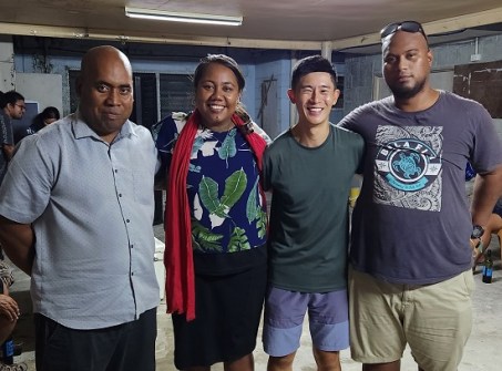
Though physically demanding on the team due to the heat, and the lack of power, refrigeration and other luxuries, for most of the team this phase was probably the highlight as they were able to spend time living alongside the locals, observing historical fishing practices, joining in the Full Village Council meetings, eating local food and swimming in the pristine waters.
The conduct of the Kiribati effort was a team effort. All surveys, data gathering and conduct of the program was undertaken by IIC, however IIC engaged support from its partners including Landpro for air operations, Guardian Geomatics (now Reach Subsea) for vessel support and Field Group, Tetratech, Shelf Subsea, Seismic Asia Pacific (SAP) and Precision Hydrographic Services (now Revelare Hydrospatial) at various times for personnel and equipment support.
Provision of an end-to-end service
IIC Technologies claims to be a ‘full spectrum geospatial provider’ and the Kiribati surveys is one of the few occasions where services across almost the entire geospatial value chain were undertaken in a single contract.
The surveys required activities in and on the land, sea and air domains. They required the establishment of horizontal and vertical control and the modelling of tides, as well as the conduct of multi-disciplinary data-gathering, processing and the generation of the various deliverables.
In addition to this, IIC ‘s UK Office then undertook the creation of charts and ENCs for these surveys under its standing charting services contracts to the UKHO.
Finally, as part of the KOITIIP delivery, IIC provided on-the-job training to MICT and KOITIIP personnel during the surveys and has subsequently provided formal education to MICT and KOITIIP staff through IIC Academy’s IBSC recognised S-5B Hydrographic Surveyors Program and the S-8B Marine Geospatial (Cartographic) Program.
The only missing part was support from IIC’s Innovation Centre; perhaps they might be able to assist MICT in the future to be able to utilise the data to fullest effect.
A lasting legacy
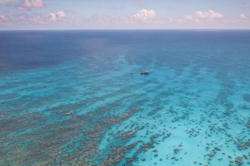
Kiribati is a beautiful nation, with friendly people and a magnificent marine dependency over which it has responsibility. The beauty of the coral reefs on the Outer Islands and the incredible volume of marine life that it supports is something that the team will not readily forget.
The surveys were fun and interesting, and at times very challenging due to the isolation and climate, but ultimately they were incredibly rewarding. One of the things that all the team members will remember is the smiling faces of the local people, in particular the children who followed us everywhere we went, swam with us while we set up tidal sites, and sat and watched for hours as we worked, always with huge smiles and playful laughter.
This article is too short to fully describe KOITIIP, its outcomes for the Kiribati people, the beauty of the environment, the challenges or the incredible people involved. But at the time of writing, the final data for Tarawa has been submitted by IIC, which will mean the completion of this phase of the KOITIIP Program.
With this final data submission, the Government of Kiribati now has world-class, seamless data coverage of the land and the seafloor for four of its remote outer islands and the main island of Tarawa, which it will utilise to improve safety of navigation, plan and develop economic growth and infrastructure, improve inter-island trade and increase the resilience of these vulnerable islands and their peoples.
David Crossman is Managing Director Oceania for IIC Technologies.


