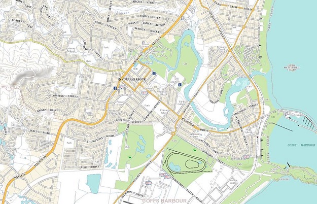
Current basemap of Coffs Harbour. Images courtesy NSW DCS Spatial Services.
NSW DCS Spatial Services is working on a project to upgrade the NSW basemap, which is currently the default view on its platforms such as the Spatial Collaboration Portal, SIX Maps and NSW Spatial Digital Twin.
In its most recent news update, Spatial Services said that “We are continuing to expand online services and the upgrade of the NSW basemap will ensure that all NSW Government customers have a dynamic view of NSW Government information displayed in map form.”
“Opportunities and enhancements have been identified to improve the range of basemaps to add new designs into our systems and make [them] available as services.”
The upgrade provides seven new basemap designs:
- Greyscale
- light grey
- dark grey
- terrain
- navigation (roads and admin data)
- topographic style, and
- topographic style relief, which includes hill shade
Spatial Services’ update provided graphics (below) showing the current basemap and examples of the new designs and inclusions.
The enhancements will become available via the Spatial Collaboration Portal in the coming months.
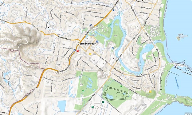
New Coffs Harbour basemap including hill shade example
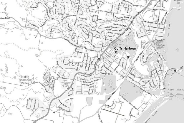
New basemap greyscale example
Stay up to date by getting stories like this delivered to your inbox.
Sign up to receive our free weekly Spatial Source newsletter.