

Image courtesy NASA/GSFC
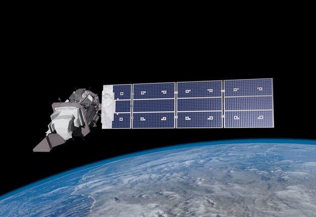
The Landsat 9 remote sensing satellite has been successfully launched into orbit aboard a United Launch Alliance Atlas V rocket.
The launch took place at 4:12am (AEST) on Tuesday, 28 September, from the Vandenberg Space Force Base Launch Complex 3E in California.
The mission is a joint effort between NASA and the US Geological Survey (USGS). According to NASA, Landsat 9 is “performing as expected” as it transits to its final orbital altitude of 705 kilometres.
“NASA uses the unique assets of our own unprecedented fleet, as well as the instruments of other nations, to study our own planet and its climate systems,” said NASA Administrator, Bill Nelson.
“With a 50-year data bank to build on, Landsat 9 will take this historic and invaluable global program to the next level.”
“Working in tandem with the other Landsat satellites, as well as our European Space Agency partners who operate the Sentintel-2 satellites, we are getting a more comprehensive look at Earth than ever before,” said Thomas Zurbuchen, associate administrator for science at NASA.
Landsat 9’s instruments — the Operational Land Imager 2 and the Thermal Infrared Sensor 2 — will operate at 11 wavelengths across a swath of 185 kilometres 30-metre resolution. Together with Landsat 8 (in orbit since 2013), it will gather images spanning the entire planet every eight days.
Stay up to date by getting stories like this delivered to your inbox.
Sign up to receive our free weekly Spatial Source newsletter.


