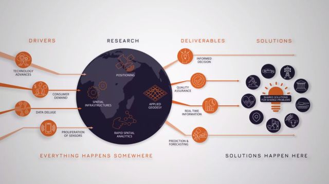
The Australian Geospatial-Intelligence Organisation’s (AGO) Analytics Lab Program (AGO Labs), coordinated through FrontierSI, was created to access innovative technology and trial new ways of working with industry.
The program aims to address AGO challenges and build new industry capability through short-term projects with Australian and New Zealand based companies. AGO Labs Challenge Topics focus on machine learning and analytics challenges for producing automated imagery analysis.
Earlier today, FrontierSI announced the three successful participants for Round 1 of the 2021 AGO Labs program Orbica, NGIS and Xerra.
‘’FrontierSI has been delighted to partner with AGO on the AGO Labs program which delivers ongoing investment into our geospatial and space-enabled industries,” FrontierSI chief executive officer Graeme Kernich said.

“The program outcomes will improve the way in which AGO and Department of Defence work with innovative companies to test new innovations and applications and develop solutions, all with the objective of strengthening partnerships to build geospatial intelligence capability,’’ Mr Kernich said.
Orbica, NGIS, and Xerra welcomed the announcement.
“The labs initiatives coordinated by FrontierSI provide a great mechanism for industry collaboration with government. Our team is excited to have the opportunity to innovate with object detection algorithms leveraging high cadence satellite imagery,” NGIS executive director Nathan Eaton commented.
Orbica CEO Kurt Janssen added: “Our team of geospatial and AI experts is excited to put the last three years of R&D to use. A core tenet of our vision is to automate intelligence from massive datasets to enhance real-time decision-making capabilities for our customers and partners. We believe this is a great opportunity for Australia and New Zealand to lead the world through collaboration and partnership.”
The AGO, in partnership with FrontierSI, will continue to attract a wider pool of companies and technologies to draw on for contemporary geospatial technologies. The primary focus of this program is to address AGO capability challenges through a small number of short-term industry projects, with a focus on machine learning and analytics for automated imagery analysis and product generation, including automated object classification.
Data scientist and project lead Joseph Corbett from New Zealand Earth Observation institute Xerra said they were “…excited to be working in collaboration with AGO, FrontierSI and their analysts to better understand the questions they ask when investigating maritime vessel behaviour”.
Mr Kernich finally noted: “We’re proud to be lead coordinators of programs like AGO Labs, which is aligned with AGO’s strategy to 2025, and which will continue to grow capability in our geospatial and space-enabled industries.”
A further three challenge topics will be released in Round 2 of the 2021 AGO Labs Program. A call for submissions will be announced by FrontierSI in April 2021 and publicised through various online channels.
Stay up to date by getting stories like this delivered to your mailbox.
Sign up to receive our free weekly Spatial Source newsletter.


