

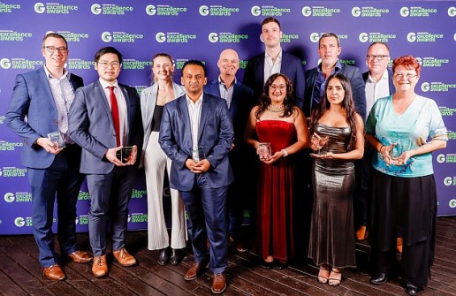
The recipients of the Geospatial Council of Australia’s (GCA) 2024 Geospatial Excellence Awards for New South Wales have been announced.
The awards were presented during a gala dinner at Darling Harbour, Sydney, on Friday, 30 August.
The recipients are as follows:
- Environment & Sustainability Award: Arup for its Digital Environmental Impact Statement for the Sydney Terminal Building Revitalisation Project (STBRP).
- Community Impact Award: Disaster Relief Australia and its GIS Team for the ‘Big Map project.
- Innovation Award (Medium to Large Businesses): FrontierSI, UNSW, MapAI, ID Consulting, Geelong Council, and Tamworth Council for establishing MapAI.
- Innovation Award (Small Business): Anditi and Main Roads Western Australia for the Main Roads Western Australia Network LiDAR Project.
- Technical Excellence Award: UNSW City Futures Research Centre and FrontierSI for MapAI.
- Workforce Development and Inclusion Award: FrontierSI for its Launching Leaders Inclusive Internship Program.
- Postgraduate Student Award: Chang LIU
- Professional of the Year Award: D’Arcy Roche
- Educational Development Award: Craig Roberts, UNSW
You can read more about each recipient and the work or projects, on the GCA website.
All recipients are eligible for the prestigious Oceanic awards competition, the recipients of which will be announced during the Locate Conference in Brisbane from 6 to 10 April 2025.
The next state-based awards event will be held during the 2024 Queensland Geospatial Conference in Brisbane on Thursday, 5 September.
And the following state and territory events will be held over the coming months:
- 20 September – 2024 Tasmanian Geospatial Conference & Excellence Awards in Launceston
- 11 October – 2024 North Queensland Geospatial Conference in Cairns
- 8 November – 2024 Western Australian Geospatial Conference & Excellence Awards in Perth
- 21 November – 2024 ACT Geospatial Conference & Excellence Awards in Canberra
You can find many more upcoming industry conferences and events listed on the Spatial Source Events page.


