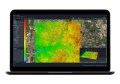
The Department for Communities and Social Inclusion (DCSI) has launched a public information search tool called MapIQ. MapIQ focuses on connecting the citizen to community based services in their neighbourhood and to the wider community.
Alberton resident Tony Yates has been introduced to a local neighbourhood he never knew existed, thanks to this new interactive online map of South Australian community services.
Developed by DCSI, using cutting-edge Geographic Information System (GIS) technology from intelligent mapping company Esri Australia, the website provides an all-access pass to information on more than 7,000 services.
This includes information on the Department’s own regional offices as well as from organisations including Connecting Up Australia, Service SA, Centrelink, and Adelaide Metro.
One of thousands of South Australians now regularly visiting the website, Mr Yates said being able to access community information by simply clicking a location on a map had reinvigorated his interest in his local area.
“At first I went online and just entered my address – and MapIQ turned up some great surprises that I didn’t realise were located at my doorstep,” Mr Yates said.
“There were community groups, as well as libraries, post offices and emergency services right near my home that I wasn’t aware of – it’s certainly opened my eyes to an exciting new neighbourhood.”
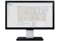
Users can search for services that may be relevant to them via either address or suburb, with most locations featuring embedded hyperlinks to further information.
Esri Australia Business Manager David Floreani said the map was the first of its kind in Australia and heralded the future of how governments would inform residents about their services.
“People are becoming increasingly reliant on accessing and viewing information, such as the location of community services, in the visual, easy-to-understand language of maps,” Mr Floreani said.
“South Australia is the first state to launch a successful services-mapping website that meets these expectations, thanks to an incredible collaboration between a number of government departments and not-for-profit organisations.
“By acting as a single-point-of-access for information from all these community service providers, MapIQ empowers residents to obtain a wealth of information from the online map using their computer, tablet or smartphone.
“The South Australian Government is leading the way with MapIQ, leveraging the same GIS technology governments around the world use to deliver information to their citizens on everything from emergency services, to council rates, to development schemes.
“We partner with state and local governments in every state in Australia, and I firmly believe each of them will be looking to this site as a benchmark.”
Mr Yates said he could see MapIQ being useful for new residents, as well as those who want to rediscover their local area.
“I’ve been living here for two years and I couldn’t believe some of the places I found while navigating the map,” Mr Yates said.
“MapIQ would also be critical to someone moving to the area for the first time, particularly a family or an elderly person.
“It displays all the local schools, churches, Seniors Card participants, medical centres, shopping centres, and public transport stops with hyperlinks to service routes and timetables.
“Everything you need know to make settling into a new area an easier experience is now just a click away.”
To access MapIQ, visit: www.mapiq.dfc.sa.gov.au