

CovidPulse: A Coronavirus Sparkline Map
 The Map Room
CovidPulse is an interactive map of COVID-19 trends—both cases and deaths—in the United States. It presents state and county-level data as a series of sparklines, which are very small line graphs.
 Maps Mania
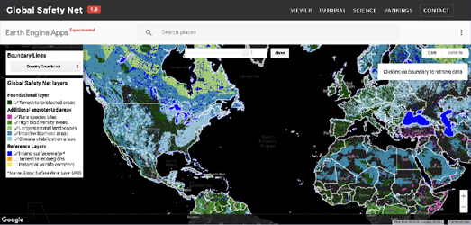
A global team of scientists has spent over two years identifying the areas around the world that need to be protected in order to save the remaining biodiversity and biological wealth of our planet. If these identified areas are not conserved then we will not safeguard our biosphere. The Global Safety Net is therefore nothing less than a blueprint which has been designed to help save planet Earth.
When real world mapping meets Tolkien
 Ordnance Survey blog
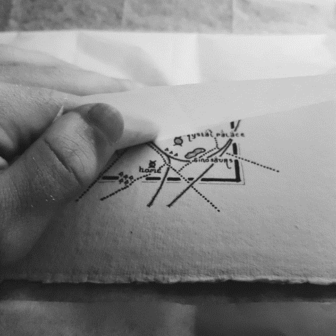
As a full-time cartographer with previous experience as an ecologist, our guest blogger Dan Bell is a huge advocate of the outdoors. In his spare time, he enjoys fell/long distance running and is currently training to become a Mountain Leader in the Lake District! If that wasn’t enough, he also runs Middle Earth’s Maps. Here, he tells us how he has used (Ordnance Survey) OS data in his Tolkien-inspired mapping.
Map of the week
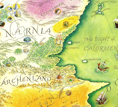
Pauline Baynes was best known as a children’s book illustrator. Her work on some of the most well known maps of the fantasy genre is less well known. She illustrated maps of Tolkien’s Middle Earth and C.S. Lewis’ Narnia.
 Maps Mania
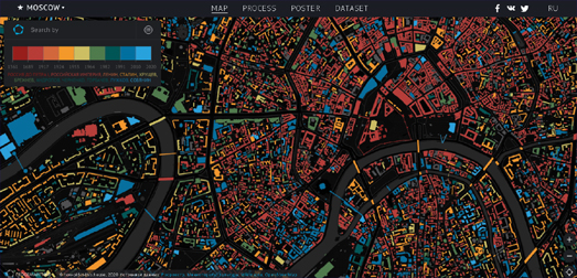
How Old is This House is an interactive map which shows the age of all Moscow’s buildings. The map uses a sequential color scheme – ranging from red for the oldest buildings to blue for the most recent. This is very effective in providing an historical overview of the age of Moscow’s buildings.
Stay up to date by getting stories like this delivered to your mailbox.
Sign up to receive our free weekly Spatial Source newsletter.


