Already recognised globally for their safe, ultra-light and easy to use drones, senseFly are now making their mark in the multirotor arena with the senseFly eXom.
Here is why professionals around the world are drawn to eXom:
1. One flight, three types of imagery
With eXom you can switch between capturing video, still and thermal imagery during the same flight, without landing to change cameras. The field of view remains unobstructed throughout the 180 degree vertical range of motion allowing you to capture clear and stablilised imagery ahead, above and below the drone.
2. Advanced situational awareness
eXom features five dual-sensor modules, positioned around the drone. These provide the situational awareness required to operate eXom close to structures and surfaces, to achieve sub millimetre image resolutions (without movement issues sometimes caused by zooming from afar and even in confined environments).
3. Choose your flight mode
eXom offers full flight mode flexibility. Choose the mode that best fits your project: an Autonomous, GPS-guided mapping mission or a live-streaming Interactive ScreenFly flight. Or start in mapping mode and ‘go live’ on demand.
Want to see the eXom in action?
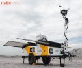
Register your interest today for a demonstration with senseFly’s Australian partner, UPG. Visit www.upgsolutions.com/eXomdemo or call 07 3851 8300 and quote promo code #eXom2015 to receive an eXom marketing pack with your demo*.
*Subject to terms and conditions.