


Hosted by the Riverina Eastern Regional Organisation of Councils and the Riverina Spatial Information Group, Mapped Out 2023 will bring together public- and private-sector professionals to learn about the latest geospatial developments.
Mapped Out will highlight the diversity of applications for spatial data, geographic information systems and their supporting technologies. Guest speakers with local and national experience will be showcasing the use of spatial data to enhance the operation and delivery of government services.
The Conference is a great opportunity for people working in regional NSW in both local government and the private sector to keep abreast of the latest technology and geographical information systems that can be utilised in their day-to-day work.
GeoBuiz Summit is an annual international conference focused on the geospatial industry, which encompasses a range of technologies and applications related to mapping, location-based services, and spatial data analysis.
The summit brings together industry leaders, government representatives, experts, and innovators to discuss the latest trends and innovations in geospatial technology and applications.
The conference covers a range of topics, including geospatial infrastructure, mapping and surveying, satellite imagery and remote sensing, location-based services, smart cities and urban planning, and much more. The GeoBuiz Summit aims to promote collaboration and knowledge-sharing within the geospatial industry and to showcase the latest developments in this exciting and rapidly evolving field.

The annual Geo Connect Asia Show & Conferences offers a two day, in-person meeting place for ASEAN’s vibrant geospatial community. Bringing geospatial solutions to the heart of decision-making the event combines with technologies from the digital construction, drone and remote sensing markets.
Geo Connect Asia looks to host its ASEAN neighbours and build on a vibrant community as new technologies add new application tools to enable the Industry 4.0 Revolution. The emergence of AI, blockchain, IoT, robotics and UAVs create a new dynamic and platforms for a region well equipped to take on the challenges ahead.

BeGeo, an initiative of the Belgian National Geographical Institute (NGI), is an annual national event for the geo sector in Belgium.
The BeGeo conference combines with a geographic information fair to bring together a wide range of players from the public sector, academia, research, the private sector and associations. This year, the organisers have once again chosen Brussels Expo as the location for the event.
BeGeo says its vision is to be a platform where important players from the sector meet and thus actively contribute to the growth of the knowledge and competences necessary to tackle complex challenges and realise the great potential of geodata.

The Australian Institute of Mine Surveyors (AIMS) Mudgee Regional Seminar will be held at Parklands Resort, Mudgee, NSW, on 22 March 2024. There will also be an optional dinner at a local brewery the evening prior.
This annual event is always very well attended, and features presentations on a wide variety of mine surveying topics and technologies. You can read an account of the 2023 seminar on the AIMS website.
Each year, the Locate conference attracts hundreds of national and international delegates from within and outside the spatial, space and surveying sectors.
As Australia’s premier spatial and surveying conference, Locate provides guests with a unique opportunity to learn about the latest trends and applications in geospatial technologies.
The 2024 event will be held at the International Convention Centre at Darling Harbour in Sydney, and will include a gala evening dinner and presentation of the Geospatial Excellence Awards (formerly the Asia-Pacific Spatial Excellence Awards).
The convenor for Locate24 will be Narelle Underwood, Surveyor-General of NSW.

The Geospatial World Forum is an annual gathering of geospatial professionals and leaders representing the entire ecosystem of public policies, national mapping agencies, private sector enterprises, multilateral and development organisations, scientific and academic institutions, and large end-users from government businesses and citizen services.
Geospatial World Forum 2024 will be held from 13 to 16 May in Rotterdam. Having its theme as ‘Geospatial Transition: Powering the World Economy,’ the event will showcase various facets of the ongoing transition of the geospatial industry and its existing and potential value in the world economy.

The Philippines will host the International Society for Photogrammetry and Remote Sensing (ISPRS) Technical Commission V (TC V) Symposium with the theme, ‘Insight to Foresight via Geospatial Technologies,’ from 6 to 8 August 2024 in Manila.
The three-day event will feature plenary and parallel sessions, exhibits, poster presentations and business meetings, and aims to inspire new methods of teaching/learning, collaboration, and promotion of accessible and easy-to-use geospatial data among engage professionals, educators and tertiary students.
ISPRS TC V focuses on the capacity building of professionals, educators and students, and in developing cost-effective teaching methods. These include distance learning programs, international collaborations on sharing web-based resources, and curricula development that meets regional needs.
- Deadline for submission of full papers for annals & abstracts for archives: 15 March 2024
- Notification of paper acceptance: 15 April 2024
- Early registration: 15 May 2024
Image credit: ©stock.adobe.com/au/Ungrim
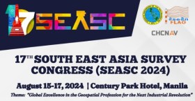
The 17th South East Asia Survey Congress (SEASC 2024) is a premier gathering of geodetic engineers, professionals and experts from across Southeast Asia. This year’s event will be held in the Philippines, a nation rich in geographical diversity and a hub for geospatial and geomatics advancements.
Themed ‘Global Excellence in the Geospatial Profession for the Next Industrial Revolution,’ SEASC 2024 promises to be an intellectually stimulating and enriching experience, bringing together experts to share their knowledge, insights, and innovations in the wide-ranging fields of geodesy, geospatial science and geomatics.
In recognition of the needs of the global community, SEASC 2024 will be conducted in a hybrid format to ensure inclusivity and accessibility, allowing both in-person and online attendees to participate fully.

The 9th International Colloquium on Scientific and Fundamental Aspects of GNSS will bring together members of the European scientific community and their international partners involved in the use of Galileo and other GNSS in their research.
The colloquium will address several major areas of research:
- Scientific applications in meteorology, geodesy, geodynamics, geophysics, space physics, oceanography, land surface and ecosystem studies.
- Scientific developments in physics with a potential impact on future GNSS, particularly in testing fundamental laws of physics.
- Aspects of metrology such as reference frames, on board and ground clocks, precise orbit determination and time and frequency transfer.
- Scientific aspects of satellite navigation, positioning and its applications.
- Other topics of interest such as big data, IoT, novel disruptive technologies, Cubesats, HAPS, UAVs and autonomous vehicles.
- Systems and technologies for navigation in space.
Image courtesy Lockheed-Martin


