

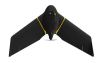
Parrot has cast a big vote of confidence in favour of its fixed-wing drone outfit senseFly.
Search results for "sensefly"

senseFly launches eBee X variant with multispectral camera
senseFly has launched an eBee X variant with the Micasense RedEdge-MX multispectral camera.

senseFly announces new leadership, partnership strategy
Maker of the eBee announces a collaborative leadership structure and emphasis on software partnerships.

senseFly boosts efficiency for corridor mapping
The new senseFly Corridor platform combines hardware and software for infrastructure surveys.

SenseFly launches eBee Ag UAV
senseFly has launched eBee Ag, a fully autonomous UAV for precision agriculture applications.

Fixed-wing mapping drone for agriculture
The eBee Ag is designed to help farmers, agronomists and service providers capture aerial data and plant health insights.

New drones, sensors dazzle at AUVSI Xponential 2019
A range of new sensors and tailored RPA solutions launched at the gargantuan industry event in Chicago.

Drones/RPAS/UAS – Surveying’s new fact or another passing fad? (Pt 2)
Surveyors’ work is increasingly being performed by UAV. Where’s it heading?

Drones/RPAS/UAS: Surveying’s new fact or another passing fad?
There are many names, but just as many opinions about their suitability as a survey tool.

18 spatial industry trends to watch in 2017
As we enter another year, you are not alone struggling to grasp the technological changes that 2017 will bring.


