A new platform from UAV innovators senseFly, known as senseFly Corridor, combines hardware and software to vastly simplify UAV mapping for linear infrastructure and sites. senseFly Corridor offers improved ground resolution, shorter image processing times and a corridor mapping ‘mission block’ to make linear mapping jobs easier.
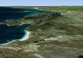
Corridor mapping is a common task for many geospatial professionals and crucial for the effective planning, design and analysis of linear infrastructure, as well as the monitoring of rivers and coastlines. However, using drones to carry out corridor projects—as an alternative to hiring expensive manned aircraft—has, until now, been a relatively complex job that contained some frustrating inefficiencies.
“senseFly Corridor overcomes these hassles, providing a geometrically and logistically efficient method of mapping linear routes,” said Francois Gervaix, senseFly’s lead product manager for surveying. “With senseFly Corridor, commercial operators can easily plan an automated corridor mapping mission, containing one or numerous flights. This release is also future-friendly, as more operators gradually look towards gaining EVLOS and BVLOS permissions.”

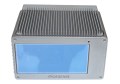
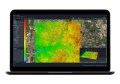
senseFly Corridor is a combined hardware and software solution, which is optimised for any eBee Plus drone that carries a senseFly S.O.D.A. photogrammetry camera. It includes: a camera integration kit, which houses the senseFly S.O.D.A. in a longitudinal (portrait) position, and a new corridor mapping ‘mission block’ within senseFly’s eMotion 3 ground station software. Together, senseFly Corridor enables better ground resolution, shorter processing times and simplified mission planning and operation.
“This corridor function is a fantastic development,” said senseFly customer, Marc A. Cañas, GISP, Vice President of National Freight Rail at Jacobs. “The corridor mapping of rail routes is a large part of our activities, so we’re excited about the flight planning efficiencies and time savings this solution will bring.”