


Researchers at QUT have developed a UAV with an on-board aircraft collision detection system.
Search results for "qut"

QUT’s inaugural SIBA chair in spatial information
QUT has appointed Dr Tim Foresman as its inaugural SIBA Chair in Spatial Information.
IGNSS 2024 early bird registrations about to close
The International GNSS Association 2024 conference will be held in Sydney from 7 to 9 February 2024.

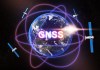
More speakers announced for IGNSS 2024
Experts in GNSS, PNT and robotics have been lined up to speak at the conference in Sydney in February.

Asia-Pacific Spatial Excellence Awards
Individuals and organisations were recognised for their achievements across a range of activities.

Australia should become a leader in HD maps
QUT expert says government and industry must cooperate on HD mapping to enable the success of autonomous vehicles.

Industry excellence recognised online
Excellence and achievement are recognised at the APSEALIVE virtual event.

Data61 to compete in DARPA’s Subterranean Challenge
LiDAR scanners on legged robots, and UAVs that fly autonomously in GPS-denied environments.

Unmasking Australia’s cancer burden
A new interactive tool uses the latest available data to break down Australia’s cancer rates.

$260 million for GNSS and imagery
SBAS to receive over $160m, along with $64m for National Positioning Infrastructure and $36m for Digital Earth Australia under 2018 budget.


